Geography of Turkey 2026 – Complete Location & Regional Guide
Why Turkey’s Geography Is So Unique
Turkey is one of the world’s most geographically fascinating countries. It’s the only place where you can literally walk from Asia to Europe across a bridge over the Bosphorus.
With diverse landscapes ranging from lush Black Sea forests to rocky Anatolian plateaus, Turkey’s geography shaped its rich history and culture. Whether you’re planning a visit or studying world geography, understanding Turkey’s unique location and natural features is essential.
This guide covers: Turkey’s location, continental positioning, regional divisions, climate zones, mountain ranges, and major waterways.
Where Is Turkey Located? Geographic Coordinates & Size
Geographic Position
Turkey is located in the Northern Hemisphere at:
- Latitude: 36–42° North
- Longitude: 26–45° East
This positioning places Turkey in a temperate zone with diverse climate regions.
Country Dimensions & Area
| Measurement | Value |
|---|---|
| Width | ~1,660 kilometers (1,031 miles) |
| Area | 783,562 square kilometers (302,535 sq miles) |
| Global Ranking | 37th largest country in the world |
| Population | ~85 million people |
Turkey’s roughly rectangular shape makes it easy to navigate and explore distinct regional characteristics.
What Continent Is Turkey In? Europe or Asia
A Transcontinental Country
Turkey is a Eurasian country with territories on two continents:
| Continent | Percentage | Region Name | Key Features |
|---|---|---|---|
| Asia | 97% | Anatolia | Plateaus, mountains, most populated areas |
| Europe | 3% | Eastern Thrace | Balkan Peninsula, proximity to EU |
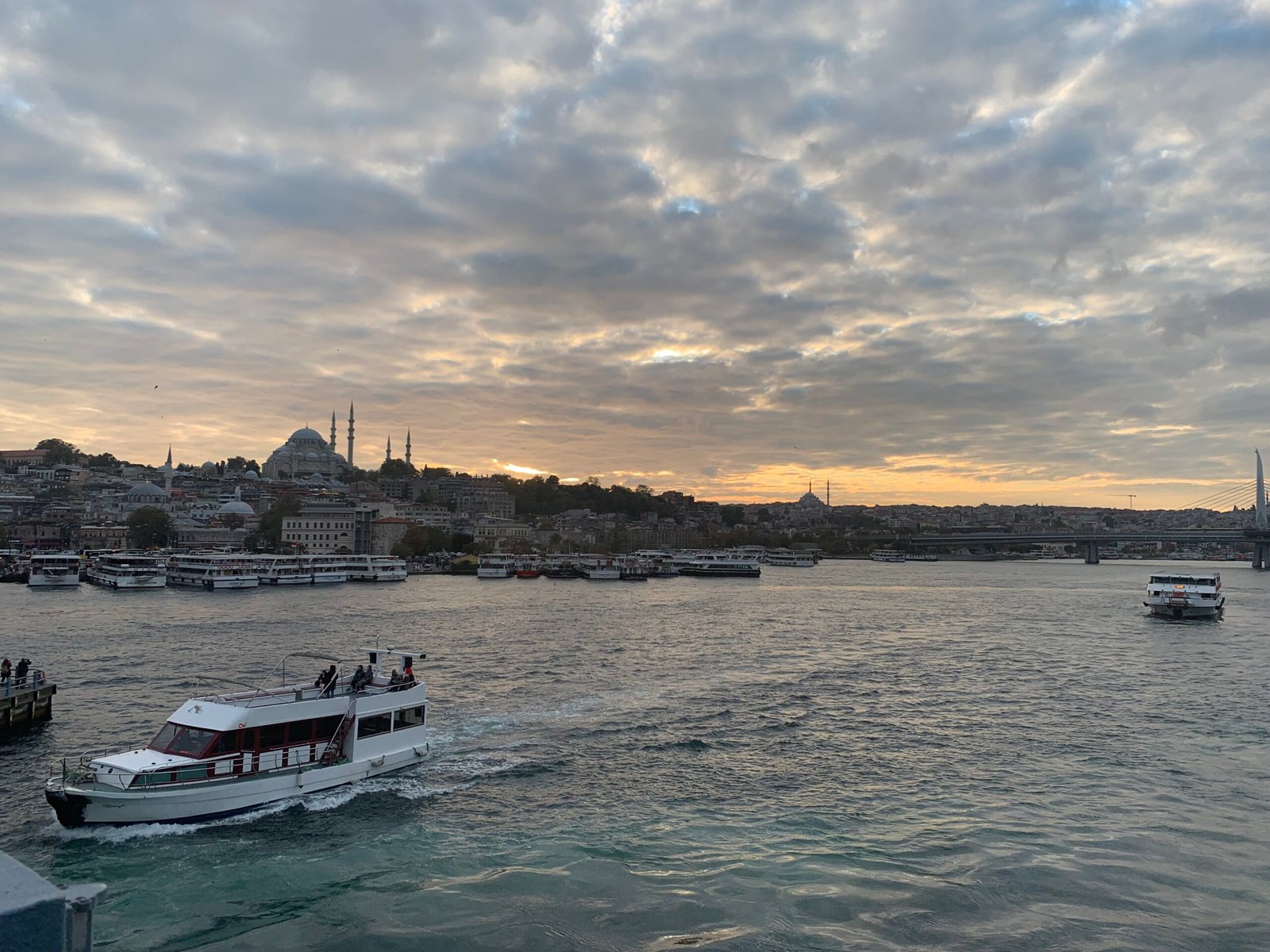
Geographical Separation: The Bosphorus & Dardanelles
The Marmara Sea contains two crucial straits separating Europe from Asia:
- Bosphorus (Istanbul Strait)
- Connects the Black Sea to the Marmara Sea
- Width: ~660 meters at narrowest point
- Separates European Turkey from Asian Turkey
- Fun fact: You can see both continents from Istanbul!
- Dardanelles (Hellespont)
- Connects the Marmara Sea to the Aegean Sea
- Ancient strategic importance (Trojan War)
Major Islands in Turkish Waters
Turkey controls several islands in the Aegean Sea:
- Tenedos (Bozcaada) – Aegean Sea
- Imbros (Gökçeada) – Aegean Sea
- Many smaller islands in the Mediterranean
Seas Surrounding Turkey: Strategic Waterways
Turkey is surrounded by water on three sides:
| Sea | Location | Characteristics | Importance |
|---|---|---|---|
| Black Sea | North | Warm ocean climate, high rainfall | Trade, tourism |
| Marmara Sea | Northeast | Connects Black Sea to Aegean | Strategic, heavily trafficked |
| Aegean Sea | West | Mediterranean climate, islands | Tourism, fishing, trade |
| Mediterranean Sea | South | Hot, dry climate | Tourism, shipping |
Eastern border: Land border with Syria and Iraq.
Turkey’s Neighbors: Bordering Countries
European Border (Eastern Thrace)
- 🇧🇬 Bulgaria (northwest)
- 🇬🇷 Greece (west and south)
Asian Borders (Anatolia & Eastern Turkey)
- 🇬🇪 Georgia (northeast)
- 🇦🇲 Armenia (east)
- 🇦🇿 Azerbaijan (east)
- 🇮🇷 Iran (east)
- 🇮🇶 Iraq (southeast)
- 🇸🇾 Syria (south)
This makes Turkey a strategic crossroads between Europe, the Middle East, and Central Asia.
Mountain Ranges & Elevation
Turkey’s Topography
Average elevation: 1,132 meters (3,714 feet)
Turkey’s terrain is dominated by mountain ranges running east-west:
Major Mountain Ranges
| Mountain Range | Location | Characteristics | Highest Peak |
|---|---|---|---|
| North Anatolian Mountains | Northern coast | Parallel to Black Sea shore | 3,937 meters |
| Taurus Mountains | Southern coast | Parallel to Mediterranean shore | 3,734 meters |
| Eastern Highlands | Far east | Highest elevations, volcanic | Mount Ağrı (5,137 m) |
Highest Peak: Mount Ağrı (Mount Ararat)
- Location: Ağrı Province, Eastern Turkey
- Elevation: 5,137 meters (16,854 feet)
- Significance: Tallest mountain in Turkey, visible from Armenia
- Geology: Dormant volcano
- Cultural importance: Biblical significance (Noah’s Ark legend)
Terrain Breakdown
- Plateaus & Plains: 1/3 of Turkey (mid-range elevation)
- Mountains: Throughout the country, especially in east
- Coastal Plains: Along Black Sea, Aegean, Mediterranean
Elevation pattern: Generally increases from west to east, with the highest mountains in eastern regions.
Major Waterways: Rivers & Lakes
Turkey’s Rivers
Kızılırmak (Red River)
- Length: 1,355 kilometers (842 miles)
- Uniqueness: Turkey’s longest river that starts AND ends entirely within Turkey
- Basin: Drains into the Black Sea
- Significance: Important for irrigation and hydroelectric power
Euphrates River (Fırat)
- Originates: In Turkey (Eastern Anatolia)
- Flows through: Syria and Iraq
- International importance: Shared water resource among three countries
- Length in Turkey: ~600 kilometers
Tigris River (Dicle)
- Originates: In Turkey (Eastern Anatolia)
- Flows through: Iraq
- International importance: Critical for Mesopotamian civilizations
- Historical significance: One of the two rivers of Mesopotamia
Major Lakes
| Lake | Location | Size | Characteristics |
|---|---|---|---|
| Van Lake | Eastern Turkey | Turkey’s largest natural lake | Highest lake in Turkey (1,648 m) |
| Tuz Lake | Central Anatolia | 2nd largest | Salt lake, shrinking due to climate |
| Ege Lake | Aegean region | Popular for tourism | Mediterranean climate |
Turkey’s Seven Regions: Geographic Divisions
Turkey is officially divided into 7 main regions, each with unique characteristics:
Regional Breakdown by Land Area
| Region | % of Territory | Key Characteristics | Best Time to Visit |
|---|---|---|---|
| Mediterranean Region | 16% | Hot, dry summers; coastal tourism; citrus fruits | April–May, September–October |
| East Anatolia Region | 21% | Mountains, harsh winters, historical sites | June–September |
| Aegean Region | 12% | Mediterranean climate, islands, ancient ruins | April–June, September–October |
| Southeast Anatolia Region | 7.5% | Hot, dry; Mesopotamian heritage; agricultural | April–May, September–October |
| Central Anatolia Region | 18% | Cappadocia, plateaus, continental climate | April–May, September–October |
| Black Sea Region | 18% | Rainforest-like vegetation, lush mountains | May–September |
| Marmara Region | 8.5% | Transition zone, includes Istanbul, urban centers | April–May, September–October |
Climate Zones: Turkey’s Three Climate Systems
Turkey experiences three distinct climate zones due to its mountain ranges and geographic position:
1. Mediterranean Climate (Aegean & Mediterranean Regions)
Characteristics:
- ☀️ Summers: Hot and dry (30°C+)
- 🌧️ Winters: Warm and rainy
- Driest months: July and August (nearly rain-free)
- Wettest month: May
- Biome: Maquis (shrubland vegetation)
Best for: Beach tourism, sunbathing, coastal exploration
Recommended Destinations: Antalya, Bodrum, Fethiye
2. Black Sea Climate (Black Sea Region)
Characteristics:
- 🌧️ Rain: Year-round precipitation (2,000–2,500 mm annually)
- 🌡️ Temperatures: Moderate, ocean-influenced
- 🌲 Biome: Forests (lush vegetation)
- Highest rainfall: On coastal areas
- Humidity: High throughout the year
Best for: Hiking, nature exploration, green landscapes
Recommended Destinations: Trabzon, Rize, Sinop
3. Continental/Terrestrial Climate (Central, Eastern & Southeast Anatolia)
Characteristics:
- ❄️ Winters: Cold and snowy (-30°C to -40°C in far east)
- ☀️ Summers: Hot and dry (30°C+)
- 📊 Temperature range: Extreme daily and seasonal variations
- ❄️ Snow duration: ~120 days in eastern regions
- 🏔️ Elevation impact: Higher elevation = colder temperatures
Winter temperatures by region:
- Eastern Turkey: -30°C to -40°C (-22°F to -40°F)
- Western inland areas: ~1°C (34°F)
Best for: Winter sports, dramatic landscapes, cultural tourism
Recommended Destinations: Cappadocia, Erzurum, Van
4. Transition Climate (Marmara Region)
Characteristics:
- 🌦️ Mixed climate: Blend of Mediterranean, Black Sea, and continental
- South: Mediterranean-style (warm, dry)
- North: Black Sea-style (rainy, moderate)
- Northwest: Continental-style (variable)
- ❄️ Snow: Occasional, rarely stays more than a few days
Geological Features: Faults & Volcanic Activity
Seismic Activity: Earthquake Risk
Turkey sits on multiple fault lines, making it tectonically active:
Major Fault Line:
- North Anatolian Fault: Runs east-west across northern Turkey
- Significance: Historically caused major earthquakes
- Length: ~1,600 kilometers
- Recent activity: 1999 Marmara earthquake, 2023 earthquakes in southeast
Earthquake frequency: Turkey experiences regular seismic activity; travelers should be aware but not alarmed.
Volcanic Features
- Dormant volcanoes: Mount Ağrı, Mount Erciyes, Mount Nemrut
- Last eruption: Centuries ago
- Geological interest: Volcanic soil enriches central Anatolian agriculture
- Tourism: Volcanic landscapes in Cappadocia attract millions
Why Turkey’s Geography Matters for Travelers
Strategic Advantages
✅ Transcontinental location = explore two continents in one trip
✅ Diverse climates = different experiences by season and region
✅ Mountain & coastal access = multiple activity options
✅ Historical significance = geography shaped empires (Ottoman, Byzantine, Persian)
Travel Planning Implications
- Best season: April–May and September–October (mild weather)
- Summer destinations: Coastal regions (Mediterranean, Aegean, Black Sea)
- Winter considerations: Eastern regions have harsh weather; plan accordingly
- Mountain access: Spring–autumn ideal; some passes close in winter
FAQ – Turkey’s Geography
Q: Can you really walk from Europe to Asia in Turkey? A: Yes! The Bosphorus bridges (Fatih Sultan Mehmet Bridge and the newer Yavuz Sultan Selim Bridge in Istanbul) allow you to cross from Europe to Asia. It’s one of Turkey’s most unique experiences.
Q: What is Turkey’s largest city? A: Istanbul, with over 15 million people. It’s the only city spanning two continents and was the capital of the Ottoman Empire.
Q: Is Turkey in Europe or Asia? A: Both! 97% of Turkey is in Asia (Anatolia), while 3% is in Europe (Eastern Thrace). This makes it transcontinental.
Q: What are Turkey’s natural resources? A: Agricultural products (wheat, tobacco, cotton), minerals (chromite, boron), geothermal energy, and hydroelectric potential from its rivers.
Q: Is Turkey mountainous? A: Yes, about 1/3 of Turkey consists of mountains and plateaus. The terrain gets more mountainous from west to east, with the highest peaks in the east (Mount Ağrı at 5,137 meters).
Q: What’s the climate like in Turkey? A: It varies by region. Coastal areas have Mediterranean or Black Sea climates (mild). Inland regions have continental climates with hot summers and cold winters. Eastern regions have harsh winters with temperatures dropping to -30°C.
Q: How many regions does Turkey have? A: Turkey is divided into 7 geographic regions: Mediterranean, East Anatolia, Aegean, Southeast Anatolia, Central Anatolia, Black Sea, and Marmara.
Summary
Turkey’s unique geography—straddling two continents, surrounded by three seas, and featuring diverse climate zones—makes it one of the world’s most geographically interesting countries.
From the snow-capped mountains of the east to the Mediterranean beaches of the south, from the lush Black Sea forests to the surreal Cappadocia landscape, Turkey offers extraordinary geographic diversity.
Understanding Turkey’s location, regions, and climate will help you:
- ✅ Plan trips to suitable regions by season
- ✅ Appreciate the country’s historical significance
- ✅ Navigate the diverse landscapes
- ✅ Pack appropriate clothing for different regions
Ready to explore? Check out our Istanbul guide, Cappadocia guide, or regional guides for specific destinations.
Suggested Internal Links
- Istanbul Travel Guide – All You Need to Know
- Cappadocia Travel Guide – Fairy Chimneys & Hot Air Balloons
- Turkey Travel Guide 2026
- Turkey Regions Overview
- Food & Drink Prices in Turkey 2026
- Turkish History & Culture